The maps below show Pancha Village in 2005 and 2015. Summarise the information by selecting and reporting the main features, and make comparisons where relevant.
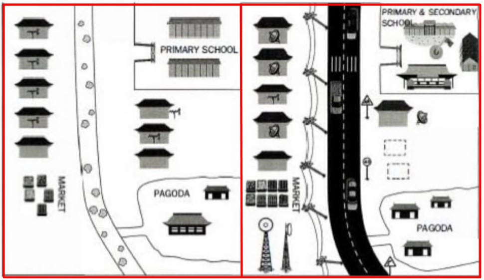
The yielded map demonstrates the changes in punch village from 2005 to 2015.
Overall, it can be clearly seen that the village became more advanced and improved in infrastructure after an advancement.
In 2005, soil and rocks surface road passed through the centre of the village, and it also divided the village into two parts. In the northeast corner was a primary school, whereas the pagoda was on the southeast side; however, the opposite side of it was the market. Both sides of the road had several accommodations.
After a decade, all places locations remained the same, primary school and market were the same as was in 2005 although, it was reconstructed and was modern. The biggest change made in the road was cement concrete and had traffic instructor such as driving the speed limit, road indication tag moreover, on the left side of road electricity tower pass. Accommodation and pagoda were same although the number of the house in pagoda rose. New network tower builds or develops in the southwest corner.
Follow Us on IELTSFever Instagram for more updates and the latest test tasks.
Also, Read The Pie Chart Gives Information About the Country of Birth of People