


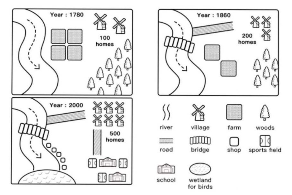

The diagrams give information about Willington’s urban development changes in the years 1780, 1860, and 2000, consecutively.
Overall, in the beginning, the town’s people were not educated or civilized, as they had no schools to attend. They also crossed the river by traditional boats until later on, when schools and a bridge were built. Forests surrounded them. 🌳🚤
In 1780, Willington was a rural area consisting of two villages with exactly 100 homes situated in the northeast of the map. Most of the residents were farmers and fishermen, while others were engaged in irrigation due to the presence of four farming lands and a river alongside the farming areas. 🚜🌾
In 1860, the number of villages rose by half, and the number of homes doubled compared to previous statistics. Roads and bridges were constructed, allowing villagers to move from their homes to the remaining two farming plots and other parts of the river. 🏘️🌉
By 2000, the town became more civilized and educated, as two schools were introduced in the southeast, alongside three sports fields. Other services, such as five shops, were built on the coastline. Six villages with 500 homes were present at the time. Additionally, a wetland for birds was created in the southwest area. All of this development occurred in the year 2000. 🏫⚽🌍
For More Updates Follow Us on IELTSFever Facebook Page