The maps below show the town of Lynnfield in 1936 and then later in 2007. Summarise the information by selecting and reporting the main features, and make comparisons where relevant.
Sample Answer of The Maps Below Show the Town of Lynnfield in 1936 and Then Later in 2007
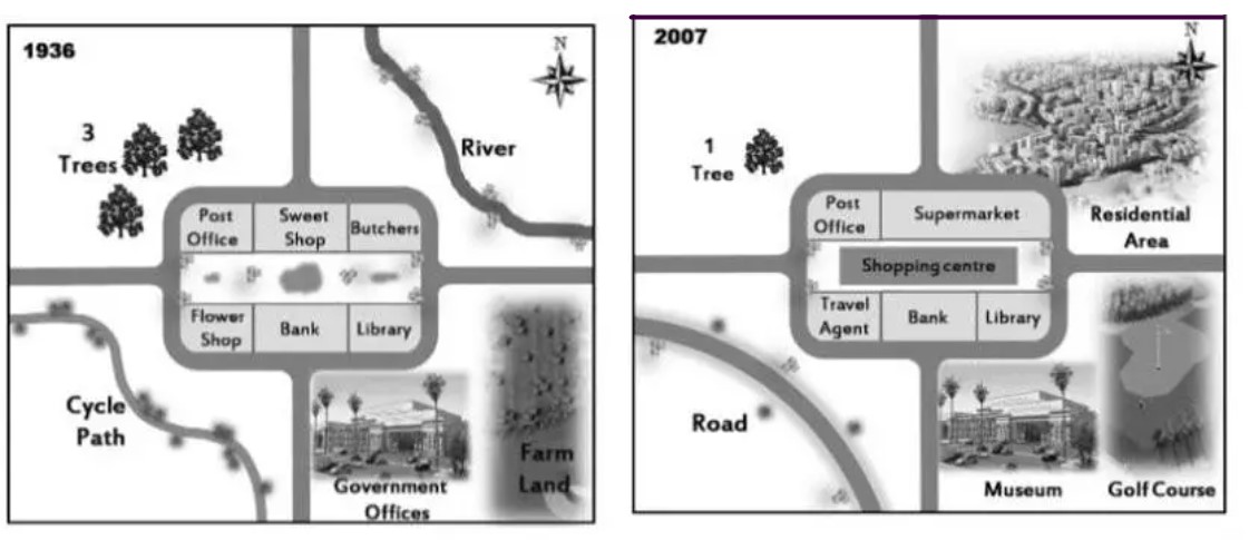
The given maps illustrate the significant changes of Lynnfield city in the two years 1936 and 2007.
Overall, the town has undergone gentrification of changes by removing the river ecosystem and deforestation.
The principal change that stands out was the river which located in the northeast to the post office was entirely abolished for the establishment of new residential apartments as such the trees to the northwest of the post office had undergone deforestation and reduced in the count. Additionally, the southeast of the town once was a government office and farmland converted into a museum and golf course, respectively.
The cycle path of the southwest of the post office was converted to a road whereas the center of the downward once a vacant place which had replaced by a large shopping centre. The butchers and candy shop to the east of the post office merged and were established as a supermarket, whereas the flowers shop to the south of the post office had been restored into a travel agency. The post office, library, and bank remain untouched.
Follow Us on IELTSFever Instagram for more updates and the latest test tasks.
Also, Read Describe a Situation When You Had to Be Friendly With Someone You Dislike