
Sample 1: The Maps Show the Changes in Shalton Village from 1910 to 2010
The given map delineates the information about how Shalton village changed its plan between 1910 and 2010
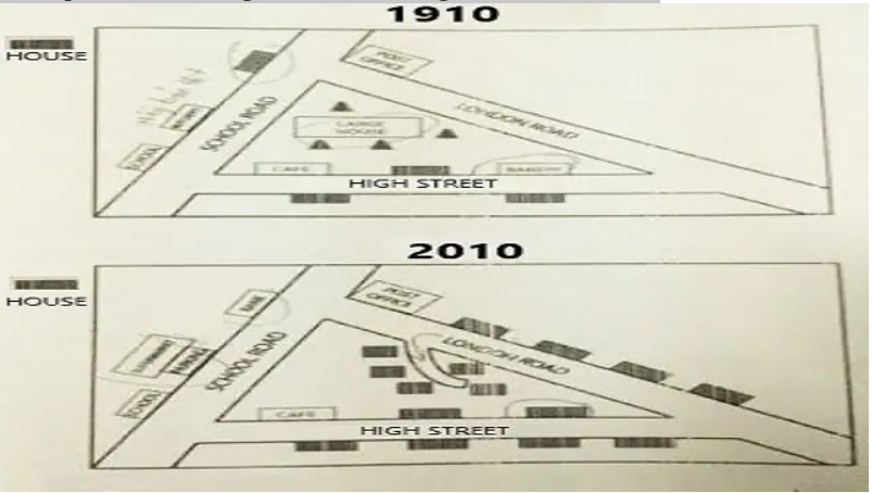
Overall, it is evident from the bird’s eye view that the building, which was constructed In 1910, remained almost the same. However, a number of new houses were built in the latter chart.
To begin with, in 1910, there were three main roads: School Road, London Road, and High Street, which connected the entire plan with each other. In the upper right corner of London Street, a post office was built, whereas a large house was placed in the centre of the plan, and a cafe was just below the large house. Furthermore, the School and Butchers were built along the school on the South-East corner.
In regards to further details, the school, Post office, and cafe remained the same in 2010. Large houses in the centre were demolished and replaced by a small road along with five houses intersecting London Street. Despite this, a plethora of homes were constructed around London Street and High Street. While in the North corner, houses were removed to make room for supermarkets and parking, respectively.
Discover more from IELTS Fever
Subscribe to get the latest posts sent to your email.