The maps below show the town of Langley in 1910 and 1950. Summarise the information by selecting and reporting the main features, and make comparisons where relevant.
 Sample Answer of The Maps Below Show the Town of Langley in 1910 and 1950
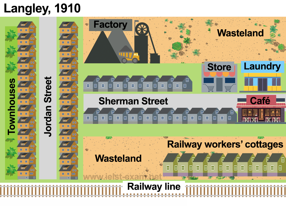
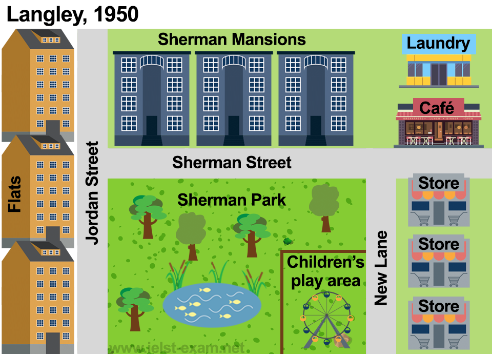
The layouts demonstrate the modifications done in a city named Langley from 1910 to 1950. Overall, townhouses, factories, wastelands, and railway lines along with the cottages were either removed, or they got replaced.
Firstly, the townhouses on Jordan Street in 1910 got substituted by the newly constructed Flats in 1950. Moreover, the factory got replaced with magnificent Sherman Mansions, and the laundry and café were shifted in 1950 to the wasteland right next to the factory from the 1910 map.
Furthermore, a new street named New Lane was introduced in 1950, and the only store present in the city in 1910 was shifted to the right side was that lane along with the addition of two new stores; earlier, this place consisted of railway cottages, café and laundry place.
Lastly, the houses on Sherman Street, wasteland along with the railway cottages on its right and the railway line got replaced by Sherman park, which had a children’s play area and a pond in it.
Follow Us on IELTSFever Twitter for more updates
Discover more from IELTS Fever
Subscribe to get the latest posts sent to your email.