The two maps below show road access to a city hospital in 2007 and 2010. Summarise the information by selecting and reporting the main features, and make comparison where relevant
Sample Answer of The Two Maps Below Show Road Access to a City Hospital in 2007 and 2010.
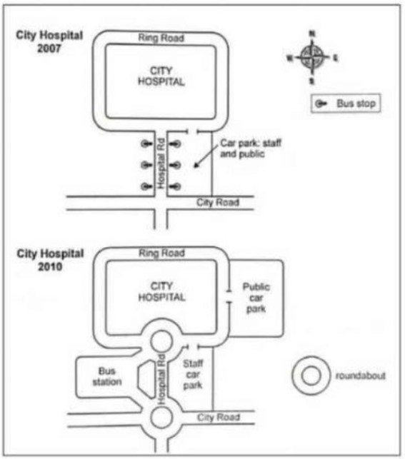
The diagram depicts the changes to the roadway approach to the city hospital between 2007 and 2010.
In 2007 there was a direct way from city road to hospital. In which various changes have been noticed throughout the time. There was Bus stop around the hospital road which was later converted into a bus station on the right side of the hospital road and connected to the roundabout on both sides of the hospital road.
There was a Car park and staff and public park on the left side of the hospital road. In 2010 it was declared as a staff car park as well as public car park moved to the east side of the ring road and connected to it.
Overall, A new bus station has been constructed which was connected with the roundabout on both sides with a city hospital and city road.
Also, Read The Charts Below Show Local Government Expenditure in 2010 and 2015
Discover more from IELTS Fever
Subscribe to get the latest posts sent to your email.